Mapping Activities
Click Map to enlarge
LiDAR Slope Map
Hi Definition Map
LiDAR imaging penetrates the vegetation to accurately record the typography, helping us to plot containment lines, tracks and water courses.
LiDAR Terrain Map
LiDAR imaging penetrates the vegetation to accurately record the typography, helping us to plot containment lines, tracks and water courses.
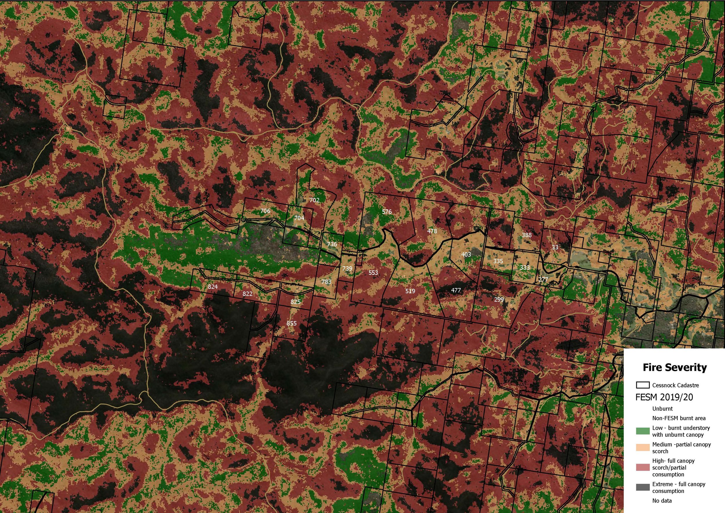
Fire Severity Map
This severity map clearly shows the impact of the Gosper and Little L fires in December 2019.
SVTM PCT
By accessing various online maps we have been able to accurately record the path of the bushfires through the valley
Fire Map CU by Mapbox
Following the black Summer fires, we have been able to source a number fire maps showing the path and coverage of our fires.
Hazards Near Me
Although sometime slow to be updated, the app does alert us to a potential threat and provide a clearer picture of the location and spread, anywhere there is an internet connection.
1865 Upper Yango Survey
The original survey map of the properties that now make up the Upper Yango Valley
1865 Survey Parchment
This is the oldest map on record of our valley. It was drawn on parchment and is from 1865. It shows colonial titles along Upper Yango Creek Road.
Asset Maps
Using Firemapper, the RFS have accurately plotted the valleys built assets, roads, standing water sources and helicopter landing sites (HLS).
Koalas
Records sightings, audio and evidence of koala presence in the valley
Gosper & Little L
Utilising available fire maps and our own references, we have been able to track the path of the fires which is helping us be better prepared for the next fire.
FIRMS_2019-12-01
Primary Threat
Understanding where the most likely fire will come from is an important understanding when developing a mitigation strategy.
Fire History
Fire Map by Mapbox
SVTM
EOSDIS Fire Map 5-12-19
Draft Native Vegetation Regulatory Map as at 11/24
The draft native vegetation regulatory (NVR) map is prepared by the Department of Planning and Environment
Parks and Forests
The publicly managed native forests that could impact Upper Yango.
Helicopter Landing Sites
HLS registered with emergency Services


