Threat Assessment
Where Bushfires Ignite
Why Upper Yango is Vulnerable?
The primary bushfire threat to the Upper Yango Valley is the Yengo National Park that borders the valley on three sides. In recent memory, all significant bushfires that have impacted the community and it’s neighbours had come from the park.
The National Parks and Wildlife Service, the NSW Government agency charged with managing the park, do not have the resources to manage fuel loads in the more than 700 square kilometres of parks to the west of Upper Yango.
To enable the Upper Yango community to effectively mitigate the threat of another serious bushfire in the valley, it must develop its own strategy and implement the initiatives itself.

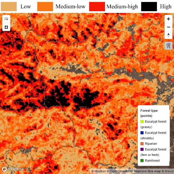
Approximately one million hectares of national parks, conservation areas and state forests are situated to the west, north and southwest.
The parks’ vast area of mostly pristine natural environment hosts an abundance of diverse ecologies and habitats, where native fauna and flora prosper, largely unhindered by human interference. It is an area of great national significance. When fires ignite in the rugged landscape they can spread quickly and become virtually impossible to contain. With a dry summer westerly wind driving the flames east and without a favourable weather change, Upper Yango and its neighbouring communities lie directly in a bushfire’s path.
The publicly owned and managed assets pose the greatest threat to life, property and the natural environment in Upper Yango and the broader Wollombi Valley.
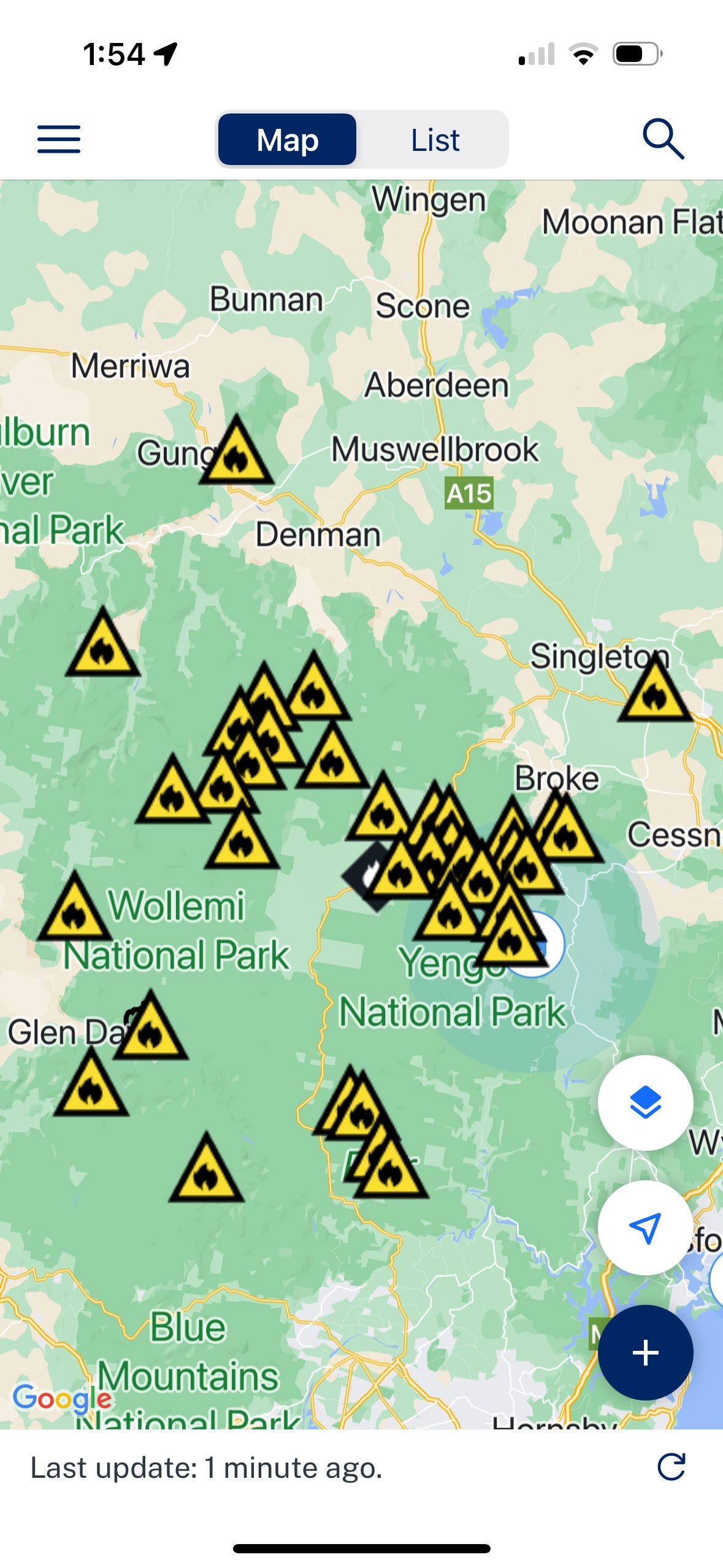
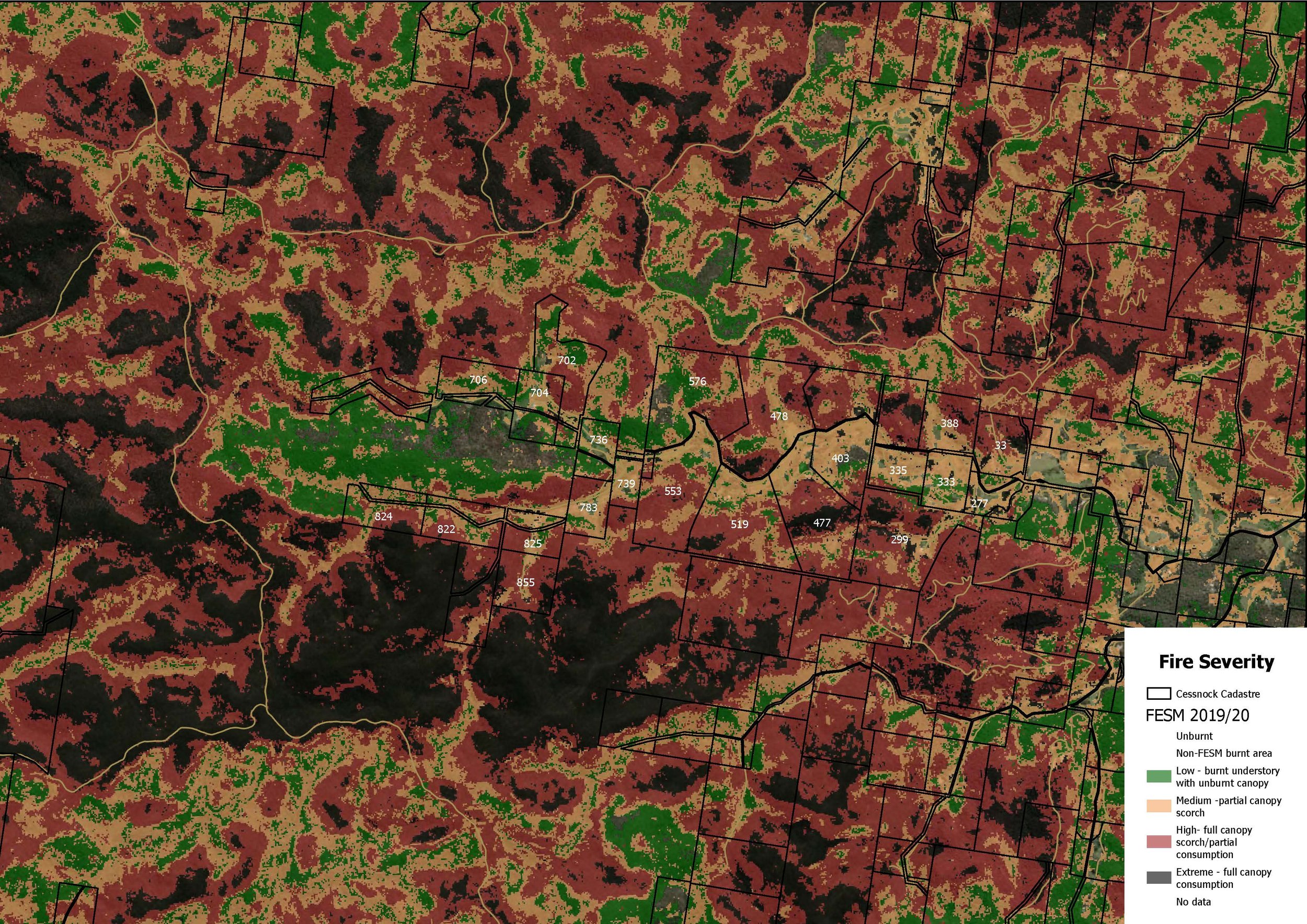
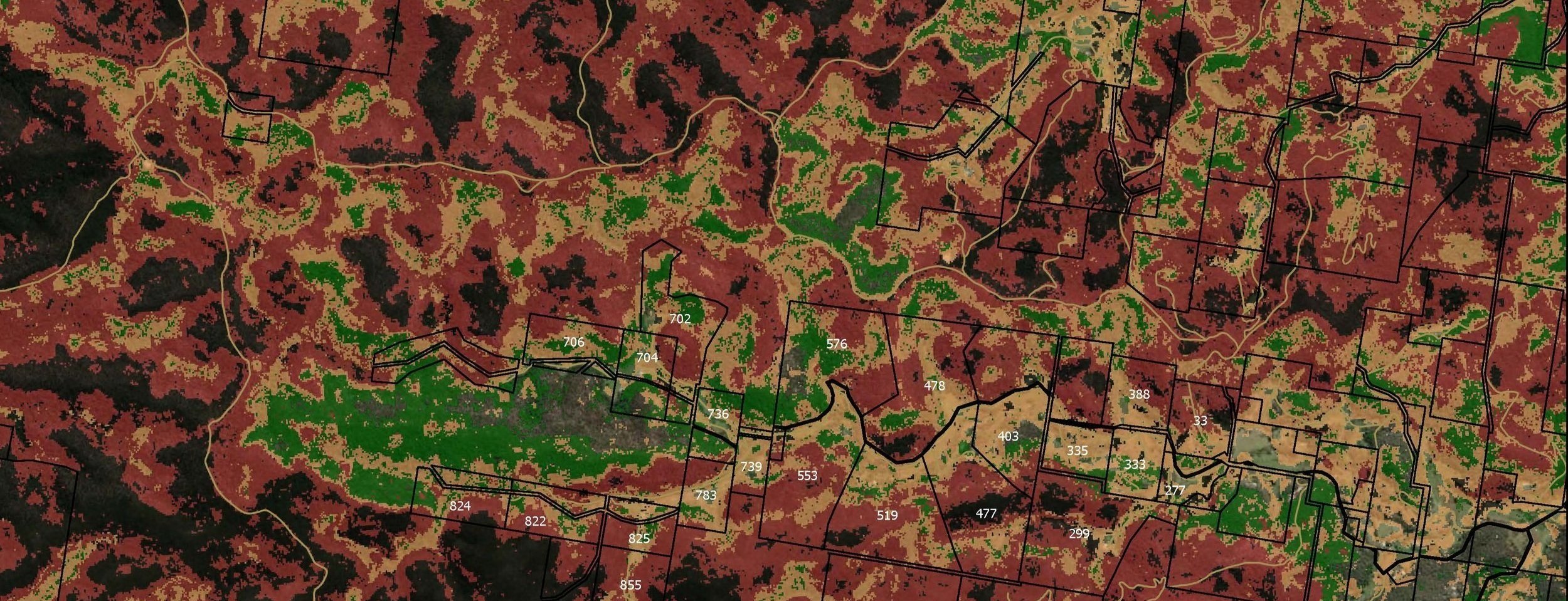
Monday 2 - Saturday 6 December 2019
Black Summer Fires - Little L & Gospers Mtn Complex - Fire Path through Upper Yango

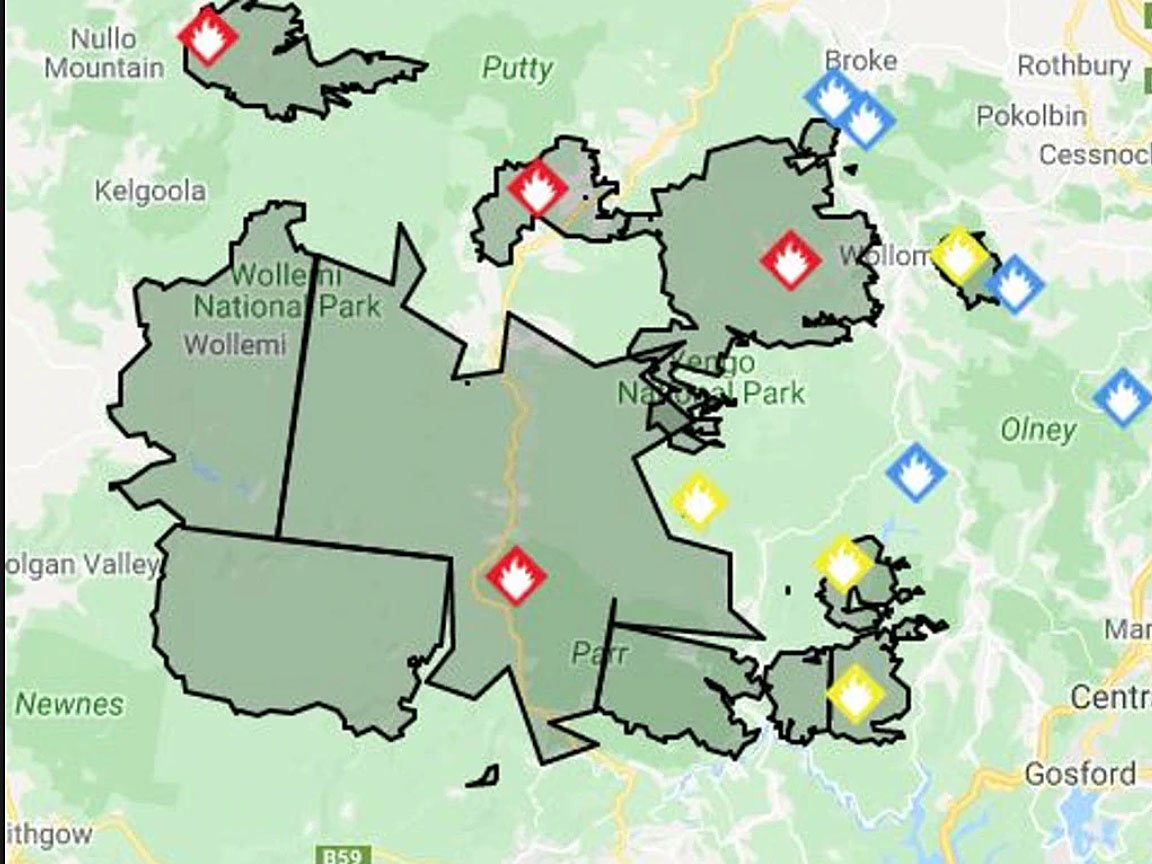
Where will the fire impact the valley?
Based on previous experience, the most likely entry points for fires are;
Western end of North Arm 708
Western end of South Arm 824
Southern end of Little South Arm 855 and Lot 162 (ALC)
The gullies at the northern ends of 708, 702, 576, 736, 480, 403, 388
Rocky Arm on the southern boundary of 519 and 477 leading to 299
Protecting Upper Yango
The threat to the Upper Yango Valley is its border with the Yengo National Park and if the prospect of developing new, far more effective strategies for managing the fire threats in the park is unlikely in the coming decade, what can the Upper Yango community do to help better protect itself from the next serious bushfire?
If previous attempts to stop an out-of-control bushfire along the Finchley and Yango tracks that follow the ridges above the valley have failed, halting the fire’s progress on the downward slope inside the valley, is surely the best strategy.
What would be required?
Firstly, a community that is 100% in agreement, unified, engaged and willing to undertake the tasks to achieve the necessary outcomes. Our community, under the auspices of The Upper Yango Landholders Association, is all of that and more.
Our Strategy
Identify the most likely entry points for the fire.
Construct containment lines at strategically key sections along the park boundaries and if permitted, in areas of the park within the valley.
Vigilantly manage vegetation and fuel loads on a rotational basis by deploying ecological mosaic burning practices (Cool Burning).
Maintain and train a cohesive and motivated community bush fire crew (The Upper Yango Bush Fire Crew).
Encourage landholders to maintain firefighting trailers and equipment.
Provide additional communal equipment including backpack leaf blowers, protective clothing and brush cutters.
Ensure the valley is covered by an effective UHF radio network and provide handsets to every landholder for use in emergencies and during mitigation and restoration activities.
Liaise closely with the Rural Fire Service, particularly Laguna Brigade, and provide comprehensive information about assets, access, mitigation initiatives and UHF radio frequencies.
Identify suitable helicopter landing sites for emergency use and have them approved and registered with RFS and emergency services.
Construct and maintain Asset Protection zones surrounding all houses and major assets.
Ensure all roads, and property access is maintained to a safe standard to allow emergency vehicular access up to RFS Category 1.
Develop a Landholder Action Plan to be implemented when a fire threat is imminent.
Pre-plan and Prepare.